My Plan / What happened
For most of my previous hikes I've driven up to the canyon, usually leaving at 4:00AM so I'd have time for travel (about 4 hours from my home in
north Phoenix) and breakfast so I could be at the South Kaibab (SK) Trailhead in the 9:00AM timeframe. This time me and my wife, Cindy, drove up
the day before and stayed at the Best Western in the small town of
Tuscayan which is outside the South Entrance. While I would be doing the grand hike, taking as many pictures, she would be doing a short day hike,
going down the Bright Angel Trail to the 1.5 Mile Resthouse and get this: meeting me as I would be hiking up! This made very tough coordination plans
as I would have to make a very accurate estimate of how long it would take me to reach that point in the trail, just over 15 miles into the hike.
This coordination would be relatively easy if there was good cell phone service, but previous visits indicated the coverage was spotty at best. And the big question was whether you could get any service within the canyon itself. A couple of previous hikes I used those 5-mile walkie talkies, but they're only good for about 3 miles and are useless if the other person isn't at least at the rim. So a cell phone would be ideal.
Getting there the day before I was eager to get over to the BA Trailhead and see if the cell phones might work. But before that I got my first look into the canyon.
From there you can see Indian Garden way below and it's so tiny you have to know exactly where to look. My heart was suddenly beating fast as I was reminded how very long this
is going to be. If I'd never done this before I could be completely oblivious, but the distance to Indian Garden looked so far and that's only a fourth of the total distance so the gravity of this effort hit
me in a very real way. From that moment and into the night the weather was far from ideal from a photography standpoint. I found myself being more than okay if it wasn't because than I wouldn't take the 5 pounds of camera equipment.
The experiment with the cell phones was not encouraging. They worked at the top of the trail, but the signal was weak.
But already at that moment I knew the phone probably wouldn't work down the
trail. At best they'd work on the upper stretches of the trail.
My plan for this "real" hike (real for me, virtual for you, and hopefully real for you one day) was to be at the SK Trailhead at 9:00AM and this particular hike I was planning for 5:45 hike. Timing would be a huge issue on this hike because my wife, Cindy, would be coming down the BA Trail to meet me at the 1.5 Mile Resthouse. If all went according to plan, I'd arrive there exactly 5 hours into my hike. Figuring it would take Cindy 40 minutes to go down the trail, she would therefore have to start her hike 4 hours and 20 minutes after I started.
Hey! That's like one of those math problems: A train leaves Chicago
traveling east at 60 MPH ... We parked in the Market Plaza parking lot right next to the Yavapai Lodge restaurant and the bus stop.
The restaurant is very convenient and fueling your body is vital and never more so than starting such a strenuous and long
hike. For this hike I was taking my Nikon D200 DSLR camera with a 12-24mm
f/4.0 lens. It would be better if the camera and lens were more compact
and a lot lighter, but it's easier to get good quality pictures with SLR and at
12mm the field of view is almost 90 degrees. I had 4 2-Gig compact flash
cards because I figured on taking 600-800 pictures. This is a
big advantage of digital over film. But I did overlook one disadvantage of
digital: power. I foolishly forgot to bring along an extra
battery.
To get to the SK Trailhead, you must get on one of the free shuttle buses (in this case the Blue Route Bus) to the Visitor's Center.
(I left Cindy with the car and she had reading material. She would just
sit in the restaurant and read until it was time for her to head over the
Bright Angel Trailhead.) You exit the bus there and take a quarter mile walk to the other end of the complex where you transfer to the South Kaibab Trail / Yaki Point (Green Route Bus) which will take you right to the trailhead parking lot. Parking lot? Yes, once upon a time in this enchanted place you could actually drive to all the lookouts.
The bus driver was standing outside waiting for the 20 minute mark so we chatted
a little. Of course he asks where I'm going and eyes me suspiciously
saying, "You're not doing the big hike with just that?" pointing to
the single 20oz water bottle and small fanny pack (which actually had two
peanut butter and jelly sandwiches. So I have to explain that I've done
this hike like this about 8 times before (thus assuring him I am in fact crazy!) and I
am adequately prepared. On this bus you're going to encounter people who
are doing down the trail and in the morning it's very obvious because you will
see people with large back packs and poles. I asked the couple sitting
directly in front of me who looked like they were prepared for a 2 day hike
where they were going and they said just to Skeleton Point. I was prepared
for their question so when they asked me where I was going, I said "The
Bright Angel Trailhead!" They had the complete look of puzzlement and
I'm sure they wanted to say, "I think you're on the wrong bus!" but I
went to explain my answer: that I was taking the long way to get to the
Bright Angel Trailhead!
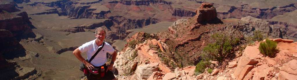
My excitement about arriving at the SK Trailhead cannot adequately be put into words. It's different than the first couple of times because now everything is so familiar. For me to traverse these trails is like visiting an old friend. On excitement alone I can move pretty fast down this trail. But for me a big advantage of having the camera is it forces me to stop and look around, if only briefly, to get the picture. The other thing that photography does for me is it forces me to look for pictures so I'm continually asking myself, "Does this or that make for an interesting picture?" Just before heading down the trail, I phoned Cindy to mark the time.
Heading down the South Kaibab, the earliness of the hour combined with the earlier date then the virtual hike in 2003 meant there were more shadows to deal with and hence some of the pictures were difficult. The trail sits next to a long limestone wall directly east so in the morning it's shaded until you get to the Ooh-Ahh Point. Instead of these pictures, I decided I should use the pictures on this part of the trail taken in May of 2005 at midday. I was guiding one of my best friends, Kevin, down the South Kaibab as part of a very short day hike and we only went to a little past the Ooh-Ahh Point and I got some pretty good pictures with good lighting. Breaking free of the wall at the Ooh-Ahh Point, the pictures after this are from the 2008 hike.
It is not easy to get great pictures when you're moving so quickly. I have no real time to compose. No time to move around a little to a better spot. So if you think the pictures are any good at all, it's strictly because the venue is so photogenic!
As I arrived at the Tipoff (the point where you enter the Inner Gorge) I could already see by my watch I was behind schedule. I knew I would have to pick up my pace a little. I checked my cell phone, but there was absolutely no signal. Had it worked I would have called Cindy and told her to give me more time. I would have asked for another 45 minutes. At that point I didn't know what I was going to do, but thinking about it more, there was only one decision to make: skip the detour to Phantom Ranch. I figured this would save me up to 25 minutes. After around 195 pictures my compact flash card filled and I had to insert a new one. No problem, I had brought 4 additional cards. But then I noticed the battery indicator was showing only 3 bars left! Why hadn't I thought to bring another battery? So from here on I paid close attention. You can extend the battery life considerably if you turn off the display. A digital SLR doesn't show the image on the screen until after you press the shutter. You have to look through the viewfinder to frame your picture. I would check frequently to see if the battery was going to last. If needed, I could throttle back on the number of pictures I was taking.
When I arrived at Indian Garden I had 2 of 5 bars showing. I was very encouraged by this because I had 3 when I was still on the South Kaibab. Somewhere between the 3 and 1.5 Mile Resthouses, it went down to one bar and I sweated out the rest of the hike. But the battery lasted!
The Pictures
From the time I parked the car at the Yavapai Lodge to the time I exited the Bright Angel Trail, I took 643 Pictures. For the most part I was happy enough with the results, but I wasn't particularly happy with the ones initially taken on the South Kaibab because I was in the shadow of the limestone wall. Part of my dissatisfaction came the simple fact that I had a pretty good set of pictures taken a couple of years earlier when I took my good friend, Kevin, down the trail just past the Ooh-Ahh Point on a wonderfully clear day in May of 2005. Since my intent was to provide a good set of pictures from the entire route and not to simply document a single hike (essentially what was done in the first virtual hike I published in 2003), I made the decision to mix the pictures. Because I did not go onto Phantom Ranch and still wanted to include pictures, the ones I've included some from the 2003 virtual hike.
Picture Breakdown:
April 13th, 2003: 13 Pictures. Canon T70 with a 28-70mm lens. 35mm film printed and scanned.
May 31, 2005: 41 pictures. Nikon D70 with an 18-70mm lens. EXIF data can be found in the images.
April 5, 2008. 390 pictures. Nikon D200 with a 12-24mm lens. EXIF data in the images.
Picture Display
Are there too many pictures? It's a fair criticism. But my feeling is I've presented them in thumbnail form and the reader can choose to click only on those pictures that seem of interest. Furthermore, I'm continually dismayed by the lack of pictures I see posted. Publishing on the web is so inexpensive that can't be a deterrent to anyone. I also don't like it when the picture quality is unnecessarily limited because of size. So almost all the pictures at full size are 1280 pixels across (if landscape) or 1280 pixels down (if portrait). What I find the most gratifying are the many emails I've received over the years from hikers who appreciate that I have taken so many pictures on all parts of the trail because they felt they didn't take nearly enough (or, they were paying attention to their hike!)
With a total of 444 pictures I decided to include a slideshow of the pictures on each of the six pages. Here I found the 1280 pixel decision problematic since most computer screens at this time only display well a picture 960 pixels across. Automatic resizing in a web application from 1280 down to 960 resulted in a loss of quality I didn't like. So I went through all 444 pictures and downsized them from the original files to the 960 which was much better.
Enjoy the pictures!
Regards,
Gene Hanson