A Virtual Hike in the Grand Canyon
Page 3 / Along the River
|
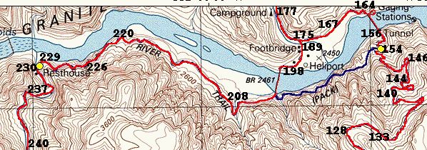
Map 3, Pictures 158-228 |
|
|
|
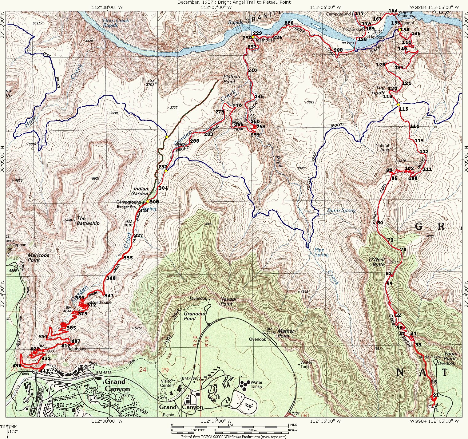
The map at the left shows the detailed view of the third part of the virtual hike. The pictures are numbered to indicate the approximate locations where they were taken. Click here if you want to see the entire map (957k) showing the entire route with the pictures marked. |
 On the South Kaibab Suspension Bridge - better known as Black Bridge.")
 Look at Boat Beach. A couple of rafting trips are parked there.")


 Note the bridge goes right into the rock wall!")


 Looking at the Indian ruins.")
|
|
If you're not in a hurry, take the small diversion down to Boat Beach. Just as the name implies, there's sand and there are generally boats. Well, not exactly boats, but rafts as this is a regular stop for the rafting trips down the Colorado. |


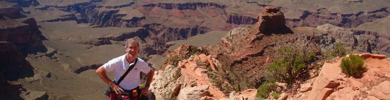
Now that you're at the bottom, the atmosphere is very different in three ways. First, there is the noise of the rushing river which seems to fill the gorge. Second, you can really feel the warmer temperatures. And third, there is considerable vegetation on the trail.
")
 The path exiting Boat Beach.")


 Bridge to Bright Angel Campground.")


 Phantom
Ranch is an oasis at the bottom of the canyon; a gorgeous setting against
the cottonwood trees and other greenery that the nearby creek make possible.
Phantom Ranch is not a five star resort. The cabins are small, there are
no bellhops, and no valet service unless you're riding in on a mule! But
as in all real estate it has the three most important essentials: location,
location, location. There seemed to be very few people about, but I did
not have enough time to really explore and enjoy the area. The heat also
weighed on my mind as it was anywhere from 95-100 degrees Fahrenheit (35-38 C) so I was anxious to get back on the main trail which
would lead me out of the canyon. Here is an excellent
map of the area from an excellent website: www.hitthetrail.com.
Phantom
Ranch is an oasis at the bottom of the canyon; a gorgeous setting against
the cottonwood trees and other greenery that the nearby creek make possible.
Phantom Ranch is not a five star resort. The cabins are small, there are
no bellhops, and no valet service unless you're riding in on a mule! But
as in all real estate it has the three most important essentials: location,
location, location. There seemed to be very few people about, but I did
not have enough time to really explore and enjoy the area. The heat also
weighed on my mind as it was anywhere from 95-100 degrees Fahrenheit (35-38 C) so I was anxious to get back on the main trail which
would lead me out of the canyon. Here is an excellent
map of the area from an excellent website: www.hitthetrail.com.


|
|
Crossing over the bridge we are back on the trail. But just on the other side of this bridge is a great stopping point as there is water and a flush toilet facility. |

")
")


.")


")
")
 Exiting the bridge we are now on the River Trail.")
 A look back at Silver Bridge and Black Bridge way in the distance.")


")


")
")


")


")
")

")


If you'd like a full-sized slideshow, click on any of the images which will take you to my Google site and launch a slideshow. Note: this slideshow isn't mobile-friendly. If you like to go to the Google page for the pictures, click here.
We've now arrived at the bottom of the Bright Angel Trail, so we are ready to ascend. There are 3 more pages to complete the entire tour. To continue on hit next.
![]()
![]()